


Leichhardt map – expedition from Moreton Bay to Port Essington, 1844-45 (paper version)
Description
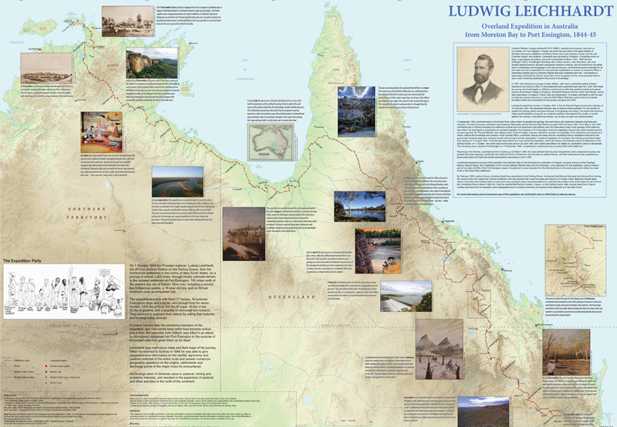
A0 (1146x790mm) size wall map featuring Ludwig Leichhardt’s Expedition from Moreton Bay to Port Essington in 1844-1845. Printed on high quality, durable 170gsm paper with a satin finish to bring out the vibrant colours, the map shows the route carved by the expeditioners during their 14-month journey. Individual campsites are marked and monthly summaries of the explorers’ endeavours, illustrated by photographs and original artworks by Australian artists Katherine Nix and Bill Gannon, are included. The map also features the Australian Dictionary of Biography’s entry on Leichhardt.
Published by the ADB, and drawn by ANU-based GIS analyst Lauren Carter, the map has been created using modern map drawing techniques with the latest geographical base data from sources such as Geoscience Australia. This unique and, we believe, currently most accurate map of the expedition is a great resource for children, educators, history buffs and Leichhardt enthusiasts.
An interactive online representation of the route along with digitised expedition journal entries can be found on the ADB web site or via Leichhardt's ADB entry.
Details
PDF Chapters
Leichhardt map – expedition from Moreton Bay to Port Essington, 1844-45 (paper version) »
Please read Conditions of use before downloading the formats.
Other publications that may interest you